Showing posts with label CityScape. Show all posts

Monday, 13 December 2010

Microsoft ICE: Panoramas Revisited

Perhaps a slow starter, but while preparing some tutorial material for our current crop of Landscape Archaeology, GIS and Virtual Environments students I came across the rather wonderful, and free, Image Composition Editor from Microsoft Research.

Not only did ICE cope quickly and easily with my clumsy trial panorama data generated from the sadly defunct CityScape,  it offered the option of output to Photosynth. Just a click and a fully working photosynth panorama, generated from my screen grabs.


Most Impressed.

Saturday, 20 November 2010

CityScape

Anyone trying to download the demo version of my favourite visualisation package CityScape will have discovered that it is no longer available as PixelActive have been acquired by mapping giant NAVTEQ.  Exactly what the future holds for this fine visualisation tool is uncertain, I can only hope that its new owners continue to support its development and availability.  NAVTEQ's website provides a rather opaque press release.

17 November 2010
NAVTEQ Acquires PixelActive
Acquisition Reinforces the Company’s Commitment to Leadership in 3D Mapping

Chicago, IL – November 17, 2010 – NAVTEQ, the leading global provider of maps, traffic and location data enabling navigation, location-based services and mobile advertising around the world, has acquired PixelActive.  The acquisition is an extension of NAVTEQ’s strategy to accelerate expansion from a 2D to 3D map, as well as providing further opportunity to leverage 3D technologies for all NAVTEQ products.
The acquisition of PixelActive Inc., a California-based company with 16 employees prior to close, supports NAVTEQ’s move to a 3D-based architecture.  PixelActive specializes in tools and technologies for 3D modeling of detailed road networks, buildings and terrain.   The company’s Cityscape product has been utilized by NAVTEQ in the development of product offerings such as 3D Junction Objects and 3D City Models.  The acquisition of PixelActive is aimed at expanding NAVTEQ’s ability to efficiently build products in a 3D environment.  Steve Rotenberg and Michael Kelley, the founders of PixelActive, will stay with the company and continue their roles in the R&D organization supporting these efforts.
“Future developments in navigation and other location-enabled solutions will rely heavily on 3D mapping capabilities,” said Cliff Fox, executive vice president, NAVTEQ Maps.  “Putting this critical product architecture in place will provide a foundation for the rapid creation of 3D content and keep NAVTEQ on the forefront of the industry.”
“The acquisition of PixelActive underscores NAVTEQ’s continued commitment to providing the most advanced digital maps,” explained Larry Kaplan, president and CEO, NAVTEQ.  “We are quickly moving to a world of 3D maps and NAVTEQ is taking the necessary steps to continue to provide our customers with a superior offering from which they can differentiate their products.”

Monday, 25 October 2010

CityScape

I'm extremely grateful to PixelActive  for providing me with a review copy of the 64-bit Pro version of my favourite visualisation tool CityScape.  I'll be experimenting with Pro, and amongst other things its export formats, over the next month or so, prior to posting a full video review.  In the meantime, it's well worth downloading the latest demo of CityScape (version 1.8.6) which includes many bug-fixes,  improvements, not least in GIS data handling and full implementation of a night-time lighting mode.


Tuesday, 31 August 2010

Anaglyph 3D

I've always been quite keen on the slightly blurry, unreal quality of 3D images (perhaps it was that View-Master I had as a child).  It seems a shame that CityScape and CryEngine are not able to produce native 3D output (ok I know CryEngine 3 is able to in its latest iteration, but I don't have that).  After some lateral thinking and with a little experimentation it has proven relatively easy to produce convincing stereo image output, albeit manually in a rather tedious, hit-and-miss process.  For the examples below, left and right eye images were generated by manually introducing a slight tracking motion to the camera view between captured stills.  I've combined the two images using the excellent, and free, Anaglyph Maker by Takashi Sekitani (which I should add also support output for interleave shutter glasses).


These examples (which are red-cyan anaglyph and so need the funky eye-wear) are from CityScape, I'm working on similar output from CryEngine, which since it offers better camera control should make anaglyph 3D movies a possibility too.

Monday, 23 August 2010

Angel

I'm working on some CityScape based visualisations of famous British landmarks for a short promo movie.  Here, as a taste, a rapid model of Antony Gormley’s  Angel of the North, familiar to anyone who regularly heads north on the A1, and my all time favourite piece of  public art from an inspirational artist.

Friday, 20 August 2010

Wednesday, 18 August 2010

Urban Landscapes

Working on some urban landscape modelling using CityScape and SketchUp.  Here is Chester Cathedral, using the excellent SketchUp model by Peter Alwyn and road data from OpenStreetMap.


Needs more work on the street furniture and a whole raft of other buildings, I shall be trying to make some simple "cardboard cut-out" buildings using the photo texture with StreetView option in SketchUp.  But for a lunchtime of work, I quite like this.

Friday, 13 August 2010

Strange Visions

More strange visions, this time panoramas of Stonehenge assembled in CityScape (top) and CryENGINE (below).  These strange mournful visions of the stones are quite beguiling.

For comparison, here below, a real photographic panorama of the stones, courtesy of the BBC.


I'm quite taken with the idea of using game engines to create artistic renderings of landscape, extending into the impressionistic, even the surreal.  Why should we be chained to photorealism by the intense graphical renderings of modern games. More experimentation, less realism...

Monday, 2 August 2010

Playing with Perception: Time-lapse Movies

I've greatly admired the urban time-laspe movies regularly posted by Andrew Hudson-Smith on his DigitalUrban blog.  There is something about the contrasting sense of stillness in the fixed landscape features and movement (people, buildings, the sky) that reveals something more than a simple static photograph.  So what about an entirely virtual timelapse movie? A recent post on DigitalUrban 15 Days in Liberty City showed the way, so here by way of shameless imitation is my own virtual timelapse, Stonehenge: Just in Time.


Modelled in CityScape by PixelActive, with video capture using the free CamStudio.  It took a little fiddling with settings in both CityScape and CamStudio to make this work, but it seems to have done the trick.

Monday, 5 July 2010

Flood Modelling and Visualisation

Continuing to explore the possibilities of using PixelActive's CityScape for modelling flooding I've gone back to some old data documenting particularly impressive floods on the River Trent, in Leicestershire, in December 1954.


This wonderful RAF air-photograph, taken at about 11am on 15th December shows the Trent in full flood, with substantial overbank flooding affecting both the north and south of the river and the area to the south (Lockington Marshes) almost completely inundated.  A south-bound express train can be seen, most visibly by its train of steam, about to cross the Trent.  But how deep was the flooding.  Some while ago we calculated the extent of the floods by comparing the photographic evidence with recent lidar terrain data.

Lidar Terrain Model.

"Flooded" lidar (in blue) superimposed on air-photograph.

Together, these two allow us to duplicate the photographically documented flooding by selective colouring of the lidar data. By our estimates the river level at Lockington was up to 1.2m above its usual winter level.  So what about visualisation?  Using Cityscape and the lidar DTM (exported as a binary grid from ArcGIS, which overcomes the GeoTiff issues) it is possible to flood the terrain to roughly duplicate the level of inundation of December 1954.

Floods of 1955 simulated in CityScape

Moving from the 2D map view CityScape allows some nice 3D visualisation of the extent and character of these floods.

Looking north-east from an earthwork platform which  
probably served as a livestock refuge.

Overlooking Sawley Cliff Farm, isolated by floodwaters.

Sawley Cliff Farm was abandoned not long after the 1954 floods and the whole area remains prone to periodic flooding.  The Lockington marshes have formed the study area for intensive research into river channel formation processes and the relationship between archaeology and dynamic river systems. Does visualisation such as this contribute to such studies? I'm not sure at present, although it may  at least open up the area to other, more visually oriented audiences.  Of course these visualisations are simply the here and now (well almost), perhaps more interesting would be to recreate the river-scape of 2000 years ago, channel movement, vegetation, environment and settlement, and then explore the impact of the dynamic River Trent on that.

Wednesday, 30 June 2010

Climate Change, Archaeology and City Modelling

I've been continuing to explore Pixel Active's excellent CityScape, particularly as its focus on urban modelling takes me into new realms of visualisation.  The ability to import OpenStreetMap mapping and SketchUp models makes rapid visualisation of many cities easy.  Below, is a quick (really quick, about 10 minutes work) model of a corner of my old home, York.  Interesting, if a little quirky and certainly in need of more work.


On adding the River Ouse to my rough landscape, it struck me that CityScape's global water level functions would allow me to flood the landscape. Memories of York's dramatic winter 2000/2002 floods prompted the following crude visualisations of somewhat more water around Clifford's Tower than I remember.


Although this crude visualisation lacks an underlying terrain model, and so any pretence of credibility, it strikes me that this function might be adapted to look at one impact of future climate change in river valleys; flooding. Climate change and cultural heritage has concerned me and other colleagues elsewhere and with other hats on, but perhaps visualisation might bring home the potential real impact of climate change on cultural heritage more than words alone.  

Friday, 25 June 2010

Vegetation and Views: Leskernick Revisited Pt. 3

Leskernick in CityScape

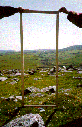
Back to the theme of investigating the landscape of Leskernick on Bodmin Moor.  The rapid landscape modelling facilities of PixelActive's CityScape, coupled with its rather wonderful cloud modelling facilities tempted me to explore using it to model part of Bodmin Moor.  So, here is a rough first attempt at visualising my 16 x 16km study area.  I've found that CityScape's import of GIS terrain data in Geotiff format is a little uneven, perhaps an issue with ArcGIS's implementation of Geotiff  as I've experienced similar problems with other Arc derived Tiffs in the past.  To get around this I've used a greyscale heightmap, "baked" onto a terrain set up with a frame of correct dimension and projection derived from a shapefile.  This seems to work well.  So, below, in homage to the original photograph, a rapid visualisation of the view through "Bender's door".  Interesting to note how changing atmospherics alter the viewing distance as the near horizon recedes into cloud.


I'll be experimenting more with CityScape for this project as I feel sure that it has much to offer and although lacking the first-person avatar-based facilities of CryEngine, its rapid landscape modelling and realistic clouds are perhaps more suited to this endeavour.

Thursday, 24 June 2010

Stone Casualties

The recent Coalition Government cancellation of the new Stonehenge Visitors Centre and associated re-routing of the A344, along with a great post in Andrew Crook's GIS and Agent Based Modelling blog inspired me to download a trial of Pixel Active's City Scape, city modelling and simulation software and try it out for archaeological landscape modelling.


The promise of GIS data input and the ability to use 3D models in industry standard formats, coupled with sophisticated visualisation and agent-based traffic simulation bodes well and immediately lends itself to a quick visualisation of the sad state of Britain's most iconic ancient monument.  So here, in a short movie, the imprisoned stones, for now at least, to remain locked within late 20th century clutter.  


Landscape based on Ordnance Survey landform profile terrain data and MasterMap mapping using again Tom Harvey's excellent SketchUp model of the stones themselves.  I'm impressed with City Scape and will return to it again in the near future.