Showing posts with label Visibility. Show all posts

Thursday, 8 September 2011

Exploring Visibility and Atmospheric Occlusion in CryEngine

The role of visual appreciation of landscape has taken a leading role in the archaeology of landscape, encouraged both by theoretical approaches and the utility of GIS softwares for automatic analysis of the visual characteristics of large landscapes.  Various writers have critiqued GIS studies of visibility and proposed enhancements to and refinements of visibility studies (eg. Llobera 1996 and 2000; Ogburn 2006).  In essence arguments for the refinement of visibilities studies focus on the need to appreciate the impact of range, view direction and target size on visibility. Additionally, a number of authors have pointed out the shortcomings of both theoretical and practical approaches to visibility studies, in particular the fact that many studies ignore or misrepresent the potential impact of vegetation and past vegetation patterns on landscape and visibility. 


I have been experimenting with using CryEngine to model different degrees of visual occlusion of landscape, based on atmospheric fog and rain.  Sandbox conveniently allows varying vegetation scenarios for the same landscape to be stored as layers that may be turned on and off to explore the visual impact of changes in vegetation.  Sandbox's environment controls allow alteration of the character, density and occlusion distance of atmospheric fog and addition the impact of rain on visibility may be simulated through particle effects.  The graphics here illustrate CryEngine simulations of the effect of increasingly dense atmospheric fog (with view distance decreasing from 200m to 500m) and the addition of rain on visibility of Stonehenge as viewed from The Cursus, a distance of just over 2km, and can be compared with a traditional GIS-derived two-dimensional viewshed diagram from the same location.


I think this approach has some potential for exploring changing visibility in landscapes where views and indivisibility are considered significant.  I'll be exploring different vegetation patterns in a similar light in the near future.


Llobera, M. 2001. Building past landscape perception with GIS: understanding topographic prominence. Journal of Archaeological Science 28, 1005-14.

Ogburn, D.E. 2006. Assessing the level of visibility of cultural objects in past landscapes. Journal of Archaeological Science 33, 405-13.


Thursday, 29 July 2010

Redhill: Visual Impact on an Archaeological Landscape 3

A final version of the Redhill visualisation completed in CryEngine. Better in the end than I anticipated, but still problematic, particularly in terms of placing digital vegetation to mirror the real-world, which becomes crucial when local vegetation can radically alter mid-range views and visibility.  

8-bit CryEngine texture mask derived from a colour
air-photograph co-registered with the terrain model in ArcGIS
CryEngine terrain model, textured using
an air-photo mask, (top) without
and (below) with vegetation models.

One innovation that I am pleased with is using air-photographs to create Sandbox texture masks to rapidly add low-resolution landscape detail.  Here I've used a colour original air-photograph, co-registered with the DTM in ArcGIS, to create an 8-bit monochrome mask, with features textured on other layers such as trees, excluded.  The end results add useful detail to the CryEngine rendered terrain and makes placement of assets such as trees and hedges easier. 


I think based on these results, and the development of a fairly robust and rapid workflow from GIS to CryEngine I'd be confident to use CryEngine to take on more ambitious GIS derived visualisations, particularly where good quality asset models already exist.

Friday, 23 July 2010

Redhill: Visual Impact on an Archaeological Landscape 2

A quick update of work on the Redhill visualisation.  The model of Ratcliffe Power Station is taking shape, cooling towers in place, buildings and main chimney to add.  I'm quite pleased with the results of adding particle effects to the cooling towers, although the "smoke" needs to be white, not black, as it is in fact water vapour.


Overall the visualisation is working out better than I had anticipated, although the proof will still be comparison with ground level photographs.

Redhill: Visual Impact on an Archaeological Landscape

I've been working on a visualisation to attempt to illustrate the visual impact of a proposed development on an archaeological landscape.  Such work is usually the preserve of landscape architects working with high-end CAD and landscape design software (see for example Griffon, et al in press).  In this example I've attempted to use CryEngine as a low-cost visualisation tool to present a ground-level view of the landscape in order to assess likely visual impact.


We're looking at the hinterland of the Roman cult site at Ratcliffe on Soar, Nottinghamshire.  This is an archaeologically important landscape (protected as a Scheduled Ancient Monument) which is poorly understood and substantially affected by previous developments including railway, power station and major roads.  The issue is the extent to which proposed future development will intrude on what remains of the unspoilt landscape setting of the Roman site.

Initial work was carried out in ArcGIS, building a terrain model and a series of land use masks derived from Ordnance Survey mapping.

GIS derived terrain model and land use mask for use in CryEngine
The terrain and masks were then used in CryEngine to build a basic landscape with correctly located river, woodland, fields and building placemarkers.  First results are below.  The overall visualisation now needs considerable work to add existing buildings, the development and landscape detail in key areas.  Results will be tested against ground level photographs for general reliability.

A selection of images from the initial CryEngine visualisation showing
the rivers Trent and Soar, woodland and building placemarkers.
I'm not convinced that CryEngine (or my modelling skills) are up to the task, particularly with the approximations in vertical scaling inherent in CryEngine, but it's an interesting project, and worth a try.

Griffon, S. et al in press. Virtual reality for cultural landscape visualization. Virtual Reality. 

Friday, 25 June 2010

Vegetation and Views: Leskernick Revisited Pt. 3

Leskernick in CityScape

Back to the theme of investigating the landscape of Leskernick on Bodmin Moor.  The rapid landscape modelling facilities of PixelActive's CityScape, coupled with its rather wonderful cloud modelling facilities tempted me to explore using it to model part of Bodmin Moor.  So, here is a rough first attempt at visualising my 16 x 16km study area.  I've found that CityScape's import of GIS terrain data in Geotiff format is a little uneven, perhaps an issue with ArcGIS's implementation of Geotiff  as I've experienced similar problems with other Arc derived Tiffs in the past.  To get around this I've used a greyscale heightmap, "baked" onto a terrain set up with a frame of correct dimension and projection derived from a shapefile.  This seems to work well.  So, below, in homage to the original photograph, a rapid visualisation of the view through "Bender's door".  Interesting to note how changing atmospherics alter the viewing distance as the near horizon recedes into cloud.


I'll be experimenting more with CityScape for this project as I feel sure that it has much to offer and although lacking the first-person avatar-based facilities of CryEngine, its rapid landscape modelling and realistic clouds are perhaps more suited to this endeavour.

Thursday, 3 June 2010

Vegetation and Views: Leskernick Revisited Pt. 2

Building the Terrain Model
The Leskernick terrain model is built using Ordnance Survey profile DTM data from the Edina Digimap service. One might equally have used lower resolution panorama data from the Ordnance Survey OpenData collection. The DTM covers an area of approximately 625km2 at a spatial resolution of 5m.  A rapid assessment of areas visible from the top of Leskernick Hill was used as a basis to select a focus area of roughly 16 x 16km, suitable for modelling in CryEngine.

The 5m resolution OS data was degraded to a lower resolution within ArcGIS, before selecting a square area 16384x 16384m and exporting this as a greyscale heightmap.


Using Sandbox a new level 2048 x 2048 units in size at 8m pixel resolution was created and the greyscale heightmap used to generate terrain.  After rough texturing and lighting the result is a CryEngine based map of the of Bodmin Moor centred on Leskernick.  Easy really, although the terrain looks a bit ropey up close and the final product will need some more work in ArcGIS and probably a smaller lower resolution heightmap for CryEngine.

Tuesday, 1 June 2010

Vegetation and Views: Leskernick Revisited Pt. 1

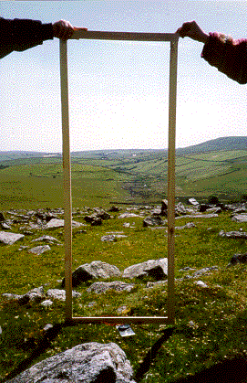
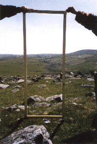
Over the next week or so I will be working on and off on an experiment using CryEngine2 to to investigate the views from the Bronze Age settlement at Leskernick, Bodmin  made famous by the phenomenological musings of Barbara Bender (Bender et al 1997) as epitomised in her photographs of views "framed" from the doors of the prehistoric houses.  Bender's work was critiqued by Chapman and Geary (2000) who pointed out that the ample evidence of past environment from the pollen record might suggest that vegetation, particularly Oak and Alder woodland, might have dramatically altered some of the views  in antiquity. So, using a combination of GIS modelling of landscape and vegetation, and CryEngine2 for visualisation, I plan to re-explore Bender's views of Bronze Age Bodmin.


BENDER, B, HAMILTON S, & TILLEY. C.1997. Leskernick: stone worlds: alternative narratives; nested landscapes. Proceedings of the Prehistoric Society 63: 147-78.
CHAPMAN H.P. & GEAREY B.R. 2000. Palaeoecology and the perception of prehistoric landscapes: some comments on visual approaches to phenomenology. Antiquity 74: 316–319.