Leskernick in CityScape

Back to the theme of investigating the landscape of
Leskernick on Bodmin Moor. The rapid landscape modelling facilities of PixelActive's
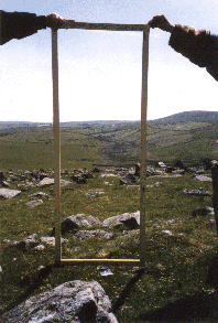
CityScape, coupled with its rather wonderful cloud modelling facilities tempted me to explore using it to model part of Bodmin Moor. So, here is a rough first attempt at visualising my 16 x 16km study area. I've found that CityScape's import of GIS terrain data in Geotiff format is a little uneven, perhaps an issue with ArcGIS's implementation of Geotiff as I've experienced similar problems with other Arc derived Tiffs in the past. To get around this I've used a greyscale heightmap, "baked" onto a terrain set up with a frame of correct dimension and projection derived from a shapefile. This seems to work well. So, below, in homage to the original photograph, a rapid visualisation of the view through "Bender's door". Interesting to note how changing atmospherics alter the viewing distance as the near horizon recedes into cloud.


I'll be experimenting more with CityScape for this project as I feel sure that it has much to offer and although lacking the first-person avatar-based facilities of CryEngine, its rapid landscape modelling and realistic clouds are perhaps more suited to this endeavour.
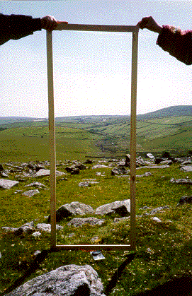 Back to the theme of investigating the landscape of Leskernick on Bodmin Moor. The rapid landscape modelling facilities of PixelActive's CityScape, coupled with its rather wonderful cloud modelling facilities tempted me to explore using it to model part of Bodmin Moor. So, here is a rough first attempt at visualising my 16 x 16km study area. I've found that CityScape's import of GIS terrain data in Geotiff format is a little uneven, perhaps an issue with ArcGIS's implementation of Geotiff as I've experienced similar problems with other Arc derived Tiffs in the past. To get around this I've used a greyscale heightmap, "baked" onto a terrain set up with a frame of correct dimension and projection derived from a shapefile. This seems to work well. So, below, in homage to the original photograph, a rapid visualisation of the view through "Bender's door". Interesting to note how changing atmospherics alter the viewing distance as the near horizon recedes into cloud.